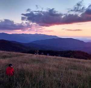
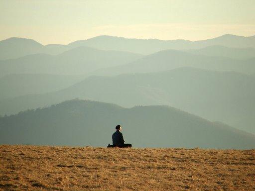
 Max Patch, NC, is one of the most enchanting destinations in the Southern Appalachian Mountains. Known for its panoramic views, lush greenery, and tranquil atmosphere, Max Patch has become a must-visit spot for hikers, nature lovers, and outdoor enthusiasts. This guide is an overview of information about visiting Max Patch, NC including essential tips for your visit, directions to the site, and what to do once you arrive. Max Patch is (sometimes called “Max Patch Bald” or “Max Patch Mountain”, but ususally just Max Patch) is a 4,629-foot tall mountain bald with an incredible 360-degree mountain vista just 20 miles from Hot Springs. The Appalachian Trail crosses right over the summit running north and south. On a clear day, you can see from Mt. Mitchell on the east to the Great Smoky Mountains on the south.
Things to Know When Visiting Max Patch
Hiking Trails at Max Patch
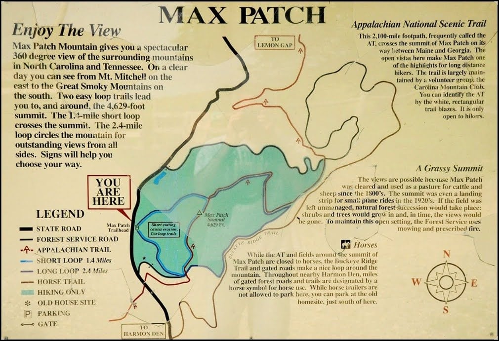
Max Patch is accessible via the Short Loop Max Patch Trail from the Max Patch trail head, as well as via the Appalachian Trail which runs directly through Max Patch. It is a moderately strenuous hike. The short loop is approximately 1.4 miles and provides stunning views at the summit. However, the trail can be muddy and slippery, especially after rain, so wear appropriate footwear. There is also a long loop which circles the Max Patch Bald and is 2.4 miles. This Map of Max Patch from the US Forest Service is a helpful reference:
Help Preserve Max Patch: Important Visitor Guidelines
 Please help preserve the natural beauty of Max Patch by leaving no trace! This includes packing out all trash, staying on designated trails, and respecting wildlife. The area can become crowded, especially during peak seasons, so be mindful of your impact. The Pisgah National Forest implemented new guidelines in 2021 to help reduce the impact of high visitor volume. They are:
- No camping.
- No fires.
- The area closes 1 hour after sundown. Reopens 1 hour before sunrise. Visitors are prohibited during closed hours.
- Group size limited to 10.
- Dogs and other animals must be on a leash no longer than 6 feet or in a crate or cage.
- Stay on designated trails.
- Aircraft may not land, drop off, or pick up anything in this area. Drones are prohibited on the Appalachian Trail.
- No fireworks.
- Bikes must stay on roads only.
- Horses and other saddle and pack animals may not be ridden, hitched, tethered, or hobbled in this area.
No public bathrooms or trash cans exist, and parking is limited at the site. As of the latest updates, no permits or fees are required to visit Max Patch. However, this can change, you can always check the official website for more information. It’s also a good idea to check for any seasonal restrictions or advisories. You can also check out their stewardship events if you want to help preserve Max Patch.
Be Prepared: Check the Weather
Before heading to Max Patch, it’s important to check the weather forecast. The weather in the mountains can be unpredictable, and conditions can change rapidly. Up on a bald there is limited shelter. Summer temperatures are usually mild, but evenings can be chilly. In winter, snow and ice can make trails hazardous. Always prepare for sudden changes in weather and dress in layers. In just about any season, Max Patch is 10-15 degrees cooler than Hot Springs or Asheville. Cell phone reception can be spotty in the area, so plan accordingly. Let someone know your plans and expected return time. Familiarize yourself with the trail before setting out and bring a light if you’re staying for sunset.
A little Max Patch History
The bald was created in the 1800’s when it was cleared for grazing of sheep and cattle. In the 1930’s, it was used as an air strip and was said to be the highest in the East. Local folk talk about how Max Patch was often used as a place for air shows with bi-planes and how thousands of people would gather there to take in the spectacle. The bald was privately owned until 1982 when the U.S. Forest Service bought 350 acres to preempt a plan to turn it into a ski resort. During COVID, Max Patch became a haven for people wanting to get out, which led to severe environmental degradation and prompted stricter visitation guidelines.
What to Do at Max Patch
 1. Hiking and Walking
The primary activity at Max Patch is hiking. The Max Patch Trail is the most popular route, offering a relatively short hike with rewarding views. For those looking for a longer adventure, there also the 2.4m long loop that goes around the mountain, or one can explore the the Appalachian Trail and connected networks. Just make sure you’re prepared for your hike! Check out the Hot Springs Appalachian Trail Hikers Resource Guide here.
2. Picnicking
Max Patch provides several scenic spots perfect for a picnic. Bring a blanket and enjoy a meal with a view of the expansive, rolling hills. Remember to pack out all waste to keep the area pristine and follow all of the Guidelines.
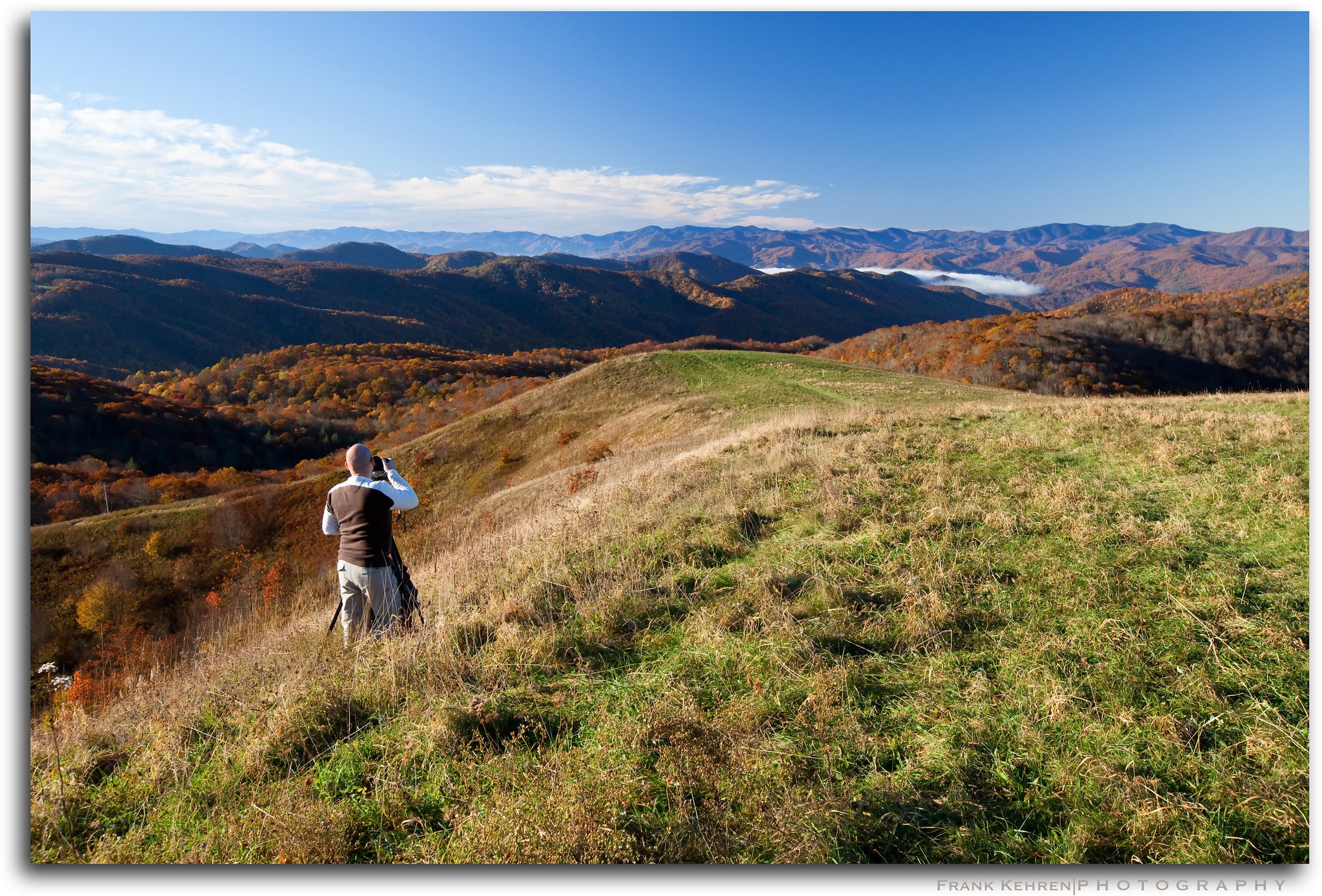
3. Sunrise, Sunsets, and Photography
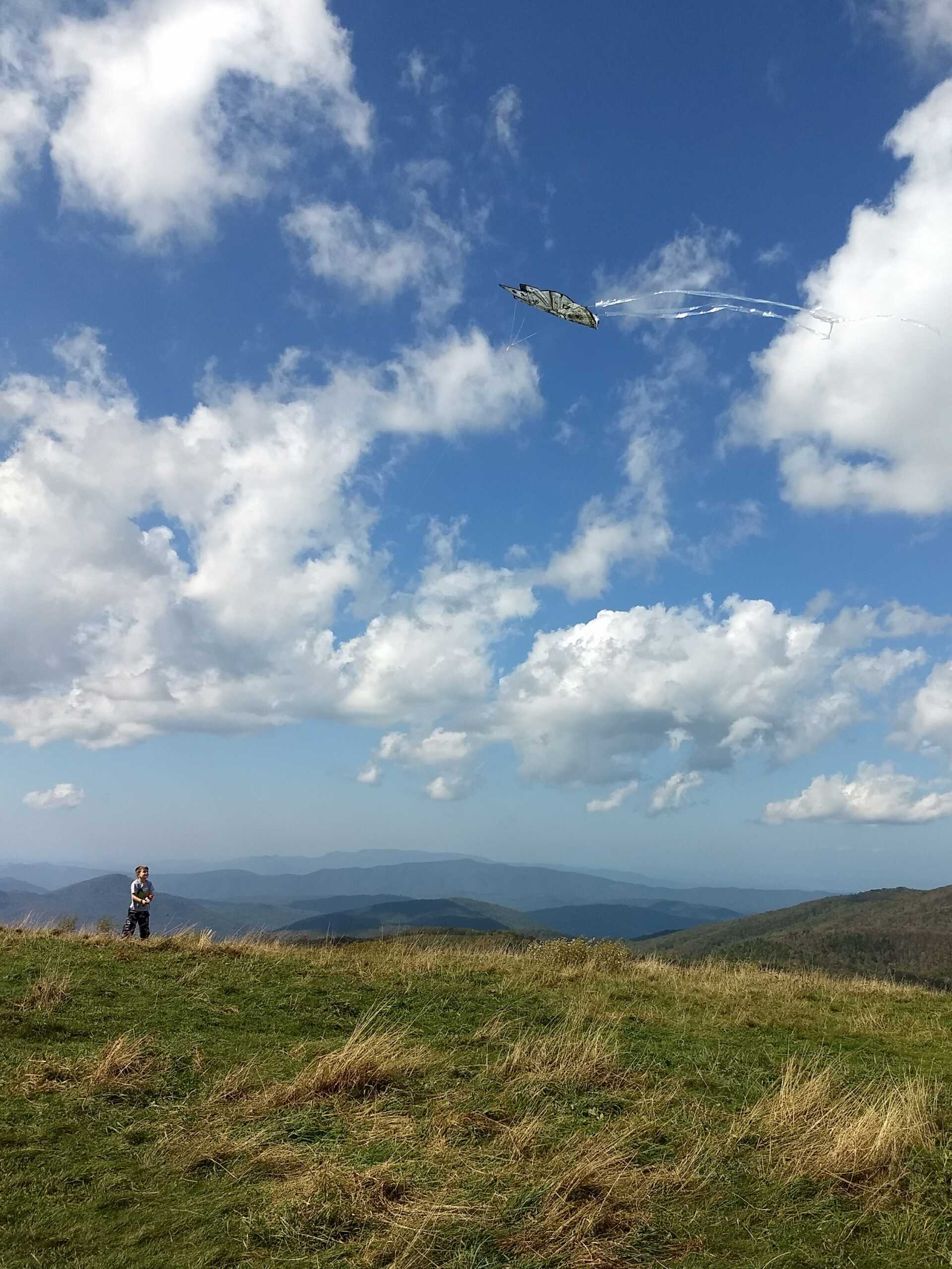
The sweeping vistas from Max Patch are ideal for photography. The views are particularly stunning at sunrise and sunset. Capture the changing colors of the landscape, and be sure to include the beautiful wildflowers that bloom in spring and summer.
4. Wildlife & Nature
Max Patch is home to diverse wildlife. Keep an eye out for deer, black bears, and various bird species. Always observe wildlife from a distance and do not feed or approach them. During springtime you’ll see an abundance of wildflowers. Max Patch is also a stopover for Monarch butterfly populations.
Nearby Attractions and Activities
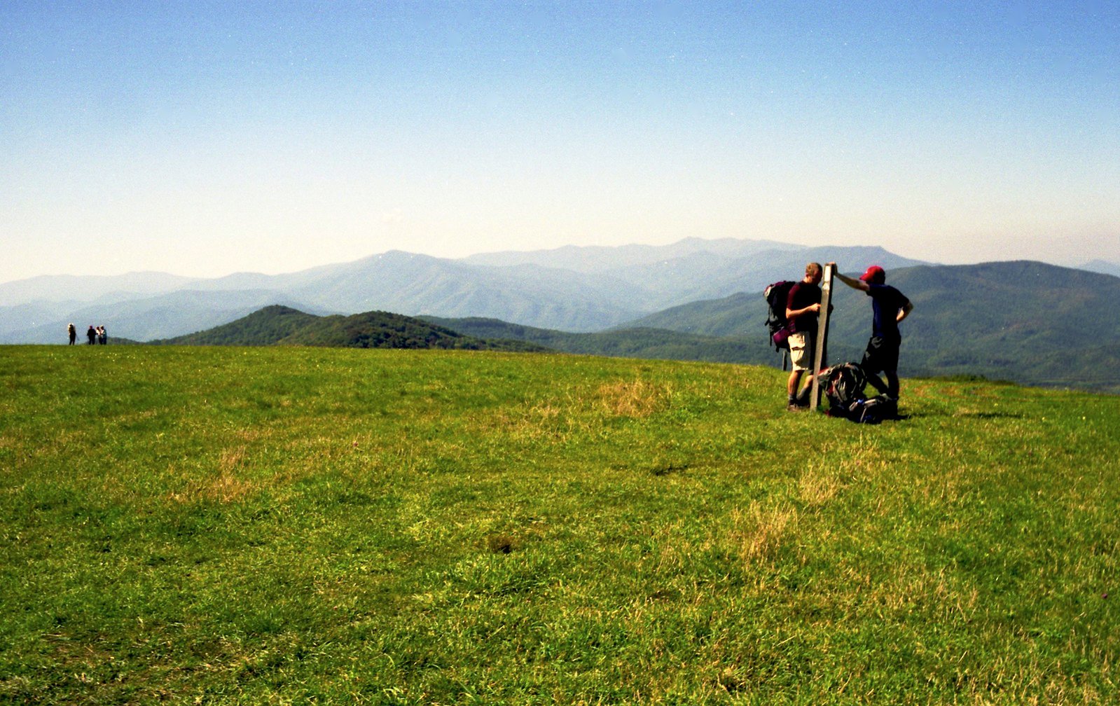
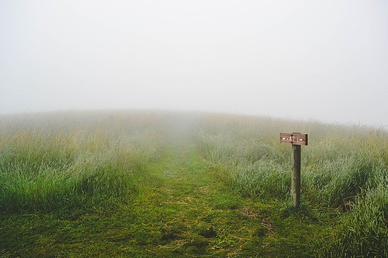
Max Patch Trail Post by Steve Bernacki
1. The Appalachian Trail
As mentioned, the Appalachian Trail, a 2,190+ mile footpath that runs along the Appalachian Mountains from Georgia to Maine, runs directly through Max Patch, as well as Hot Springs, NC. By the Appalachian Trail, Max Patch is 20 miles from downtown Hot Springs, so it’s definitely not a day hike, but you could start your trip or make an overnighter of it from Max Patch for sure!
2. Hot Springs, NC
Located about 30 minutes from Max Patch, Hot Springs is known for its natural hot springs and charming small-town atmosphere. Enjoy a relaxing soak in the mineral-rich waters or explore the local shops and eateries.
3. Drive or Ride The Rattler
Highway 209, AKA “The Rattler” runs from Hot Springs, NC to Lake Junaluska, NC. Motorcyclists and driving enthusiasts of all kinds find the 234 twists and turns and scenic bends of 209 a worthy visit and challenge. The Rattler is among the ranks of other famous routes like the Dragons Tail, Hellbender, The Snake and The Devils Triangle.
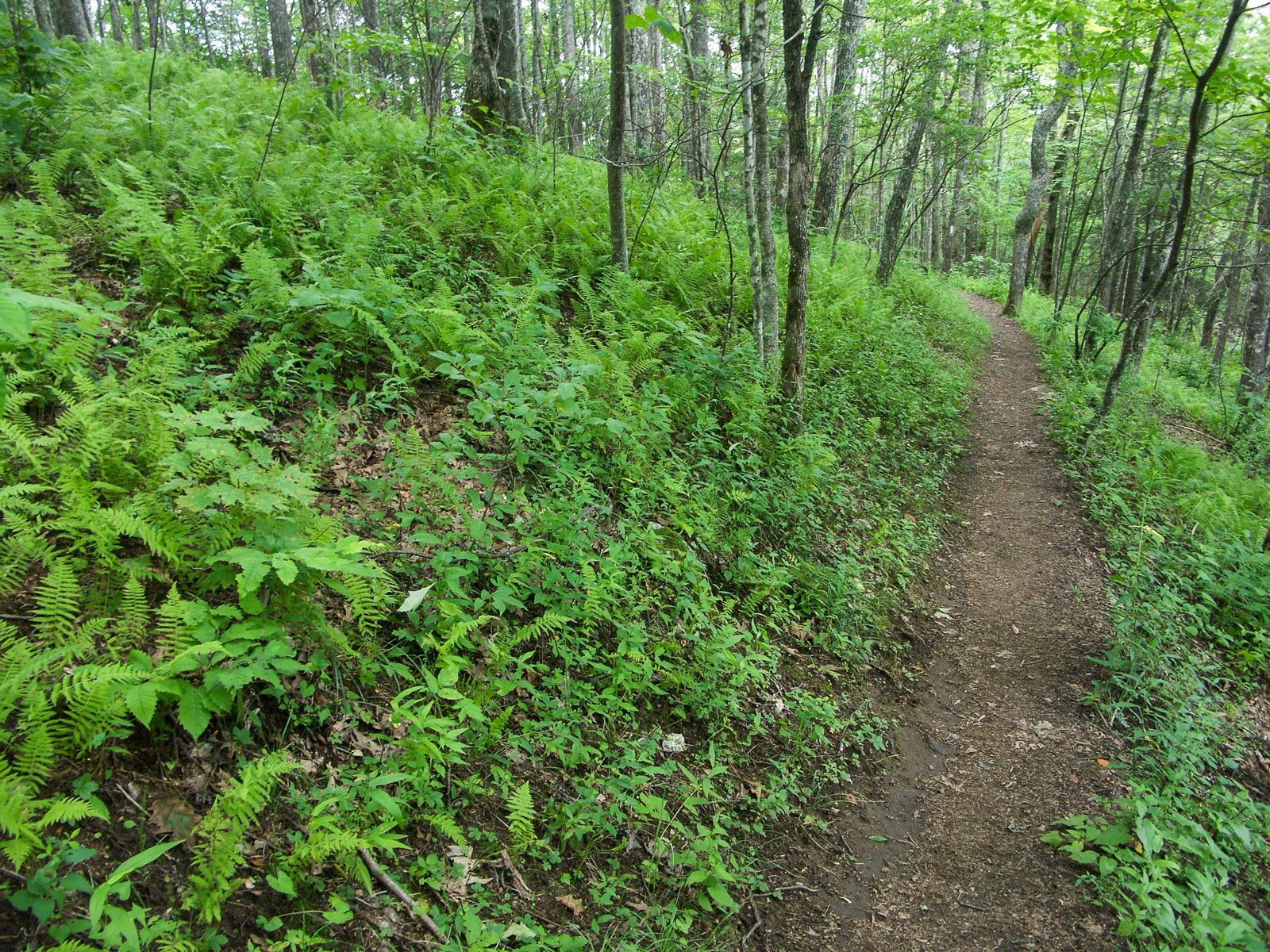
The Appalachian Trail passes through open woods near Max Patch Mountain.
4. Great Smoky Mountains National Park
A bit further afield, the Great Smoky Mountains National Park offers extensive hiking trails, historic buildings, and diverse wildlife. It’s an excellent option for a day trip or overnight stay.
5. Asheville, NC
Asheville is a vibrant city known for its arts scene, craft breweries, and historic architecture. Spend a day exploring the city’s attractions, dining in its renowned restaurants, or visiting the Biltmore Estate.
How to Get to Max Patch
Although you can get to Max Patch by Hiking the AT (it’s located between the Lemon Gap and Harmon Den areas), most folks drive to the Max Patch trailhead.
Directions From Hot Springs, NC
From downtown Hot Springs, go South on Bridge Street until it turns into Highway 209. Follow Highway 209 (7.3 miles) to Meadow Fork Road (State Road 1175) turning right. Go 5.3 miles and turn right on State Road 1181. Follow 1181 for 2 miles (turns into gravel). At the top of the mountain, turn right onto State Road 1182 and Max Patch parking lot is 3 miles.
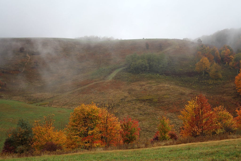
Max Patch in Fall 2 by ccho on Flicker
Directions From Asheville, NC
How to drive from Asheville to Hot Springs, NC:
- From Asheville
- Get on I-240 W/US-70 W or directly onto I-26 W
- Follow I-26 W/US-19/US-23 N to US-25 N/US-70 W
- Approx 8-9 miles depending on where you start
- Take exit 19A to merge onto US-25 N/US-70 W toward Marshall
- Travel 26.4 miles to Downtown Hot Springs, NC
How long does it take to drive to Hot Springs, NC from Asheville? It takes approximately 45 to 60 minutes depending on traffic, travel speed and where in Asheville you leave from to drive from Asheville to Hot Springs, NC.
Directions From Knoxville, TN
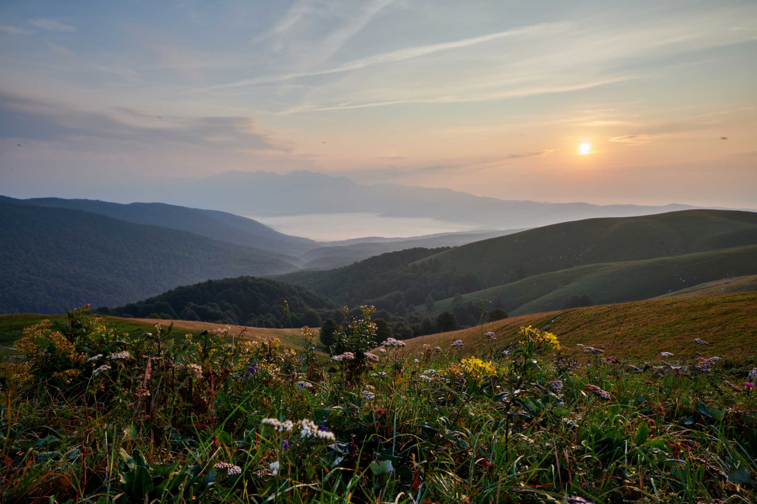
Max Patch by Samuel0Busetto
How to drive from Knoxville, TN to Hot Springs, NC:
- From Knoxville
- Get on I-40 E
- Take exit 432 for US-25W/US-70/US-411 S toward Newport/Sevierville
- Take the ramp to US-25W S/US-411 N/US-70 E
- Turn left onto US-25W S/US-411 N/US-70 E
- Continue to follow US-70 E
How long does it take to drive to Hot Springs, NC from Knoxville, TN? It takes approximately 1hr and 20min to 1hr and 30min to depending on traffic, travel speed and route to drive from Knoxville, TN to Hot Springs, NC.
 Directions From Gatlinburg, TN
How to drive from Gatlinburg, TN to Hot Springs, NC:
- Take TN-73 to US-321 N/East Pkwy
- Follow US-321 N to TN-73 E in Cocke County
- Follow TN-73 E and Edwina Bridgeport Rd to US-25 S/US-70 E
- Turn right onto US-25 S/US-70 E
- Follow US-25 into Hot Springs, NC
How long does it take to drive to Hot Springs, NC from Knoxville, TN? It takes approximately 1hr and 20min to 1hr and 40min to depending on traffic, travel speed and route to drive from Gatlinburg, TN to Hot Springs, NC.
Can you get to Max Patch via Public Transportation?
There is no public transporation to Max patch. Most visitors opt to drive or use ride-sharing services from nearby cities. Ensure your transportation method can handle the gravel roads leading to Max Patch.
 Enjoy your Max Patch Visit!
Max Patch, NC, is a remarkable destination that offers a blend of natural beauty and outdoor adventure. With its sweeping views, accessible hiking trails, and peaceful atmosphere, it’s a perfect spot for nature enthusiasts and casual visitors alike. By following this guide, you’ll be well-prepared for a memorable and enjoyable experience at one of North Carolina’s hidden gems. Whether you’re hiking to the summit, enjoying a picnic, or simply taking in the views, Max Patch promises to be a highlight of your mountain adventures.
– Article by CJ O’Reilly, February 2025
Directions to Max Patch from Hot Springs updated 09/24/2025